Picture 1 of 2
Stock photo


Picture 1 of 2
Stock photo


Postcode Atlas of Britain and Northern Ireland by Collins Maps (Hardcover, 2012)

uk_better_world_books (488167)
98.5% positive Feedback
Price:
£11.98
Free postage
Returns:
30 days return. Buyer pays for return postage. If you use an eBay delivery label, it will be deducted from your refund amount.
Condition:
Book
- Buy it nowPostcode Atlas of Britain and Northern Ireland Hardcover Collins
Oops! Looks like we're having trouble connecting to our server.
Refresh your browser window to try again.
About this product
Product Information
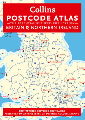
An essential business tool, this atlas clearly shows the postcode boundaries (down to district level) for the whole country on detailed colour mapping. In central London postcodes are shown to sector level. Scale of main maps: 1:263,000 (4.15 miles to 1 inch). MAIN FEATURES This invaluable atlas shows postcode areas and districts for the whole of the UK and has been updated with all the latest boundary changes. INCLUDES * Postcode areas (e.g. SW) and postcode districts (e.g. SW8) for the whole of the UK. * Postcode sectors (e.g. SW8 4) for Central London. * Busy conurbation areas at an enlarged scale of 1.6 miles to 1 inch. * Information on the structure and uses of postcodes. * Full colour map and a gazetteer listing of the administrative areas incorporating administrative changes that occurred in April 2009. * Full index to place names. * Index to postcode abbreviations. * Comprehensive background map detail which means the atlas can also be used for route planning and navigation. AREA OF COVERAGE Covers the whole of Britain and Northern Ireland. WHO THE PRODUCT IS OF INTEREST TO This atlas is aimed at the business user who will find it an invaluable tool for many applications including market analysis, distribution planning and sales territory organisation.Product Identifiers
PublisherHarperCollins
ISBN-139780007443079
eBay Product ID (ePID)111509250
Product Key Features
Number of Pages224 Pages
Publication NamePostcode Atlas of Britain and Northern Ireland
LanguageEnglish
SubjectGeography & Geosciences, Government
Publication Year2012
Map Scale1:263000
TypeTextbook
AuthorCollins Maps
FormatHardcover
Dimensions
Item Height303 mm
Item Weight1270 g
Item Width216 mm
Additional Product Features
Country/Region of ManufactureUnited Kingdom
Title_AuthorCollins Maps
All listings for this product


Ratings and reviews
Most relevant reviews
- 25 Oct, 2016
Thanks
Verified purchase: YesCondition: Pre-owned


