Picture 1 of 1

Gallery
Picture 1 of 1
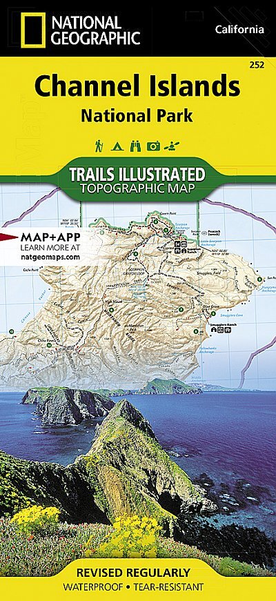

Channel Islands National Park Map Trails Illustrated Maps Nat geo ZZZ
£12.36
Condition:
New
A new, unread, unused book in perfect condition with no missing or damaged pages. See the seller's listing for full details.
5 available
- Buy it nowChannel Islands National Park Map Trails Illustrated Maps Nat geo ZZZ
Oops! Looks like we're having trouble connecting to our server.
Refresh your browser window to try again.
Postage:
Doesn't post to United States.
Located in: Caistor, Lincolnshire, United Kingdom
Delivery:
Varies
Returns:
60 days return. Buyer pays for return postage. If you use an eBay delivery label, it will be deducted from your refund amount.
Payments:
Get more time to pay. See payment informationfor PayPal Credit - opens in a new window or tab
Shop with confidence
Seller assumes all responsibility for this listing.
eBay item number:375329830607
Item specifics
- Condition
- Book Title
- Channel Islands National Park Map
- ISBN
- 9781566954105
- Publication Name
- Channel Islands National Park: Trails Illustrated National Parks
- Publisher
- National Geographic Maps
- Subject
- Transportation
- Publication Year
- 2012
- Type
- Travel Map
- Format
- Sheet Map
- Language
- English
- Item Height
- 235 mm
- Map Scale
- 1:50000
- Item Weight
- 95 g
- Item Width
- 108 mm
- Number of Pages
- 1 Pages
About this product
Product Information
National Geographic's Trails Illustrated Maps are the most detailed and up-to-date topographic recreation maps available for US National Parks, National Forests and other popular outdoor recreation areas. A necessity for exploring the outdoors, each map is printed on waterproof, tear-resistant material. They also contain key safety and contact information, GPS and compass coordinates, Leave No Trace ethical guidelines and hundreds of points-of-interest, including scenic viewpoints, campgrounds, boat launches, swimming areas, marine sanctuaries and wildlife refuges.
Product Identifiers
Publisher
National Geographic Maps
ISBN-13
9781566954105
eBay Product ID (ePID)
117367469
Product Key Features
Number of Pages
1 Pages
Publication Name
Channel Islands National Park: Trails Illustrated National Parks
Language
English
Subject
Transportation
Publication Year
2012
Map Scale
1:50000
Type
Travel Map
Format
Sheet Map
Dimensions
Item Height
235 mm
Item Weight
95 g
Item Width
108 mm
Additional Product Features
Country/Region of Manufacture
United States
Item description from the seller
Seller business information
VAT number: GB 135193128
I provide invoices with VAT separately displayed.

Seller Feedback (164,283)
- t***z (214)- Feedback left by buyer.Past 6 monthsVerified purchaseBucket list map of GB. Arrived quickly and safely. Brand new, exactly as described. Packed full of information about places to visit. I intend to give it as a gift, I’m sure the recipient will love it. Good communication from the seller too. I would definitely buy from them againSolid Gold Bucket List Map of Great Britain Christmas gift idea (#387255480242)
- 0***5 (2023)- Feedback left by buyer.Past monthVerified purchaseExactly as described. Rapid despatch. Very well wrapped. Faultless communication. Many thanks.
- s***p (319)- Feedback left by buyer.Past 6 monthsVerified purchaseItem as described, sent promptly, well wrapped. Many thanks. Meteodale is a very good seller of walking related books & maps. Will use again.
More to explore:
- National Geographic Folding Map Maps & Atlases,
- Illustrated Maps & Atlases in English,
- World Maps & Atlases in English Illustrated,
- Scottish Maps & Atlases in English Illustrated,
- National Geographic Wall Maps,
- National Geographic Maps & Atlases,
- Folding Map Maps & Atlases,
- London Folding Map Maps & Atlases,
- Hiking Map Maps & Atlases in English,
- French Maps & Atlases Folding Maps
Seller Feedback (164,283)
- t***z (214)- Feedback left by buyer.Past 6 monthsVerified purchaseBucket list map of GB. Arrived quickly and safely. Brand new, exactly as described. Packed full of information about places to visit. I intend to give it as a gift, I’m sure the recipient will love it. Good communication from the seller too. I would definitely buy from them againSolid Gold Bucket List Map of Great Britain Christmas gift idea (#387255480242)
- 0***5 (2023)- Feedback left by buyer.Past monthVerified purchaseExactly as described. Rapid despatch. Very well wrapped. Faultless communication. Many thanks.
- s***p (319)- Feedback left by buyer.Past 6 monthsVerified purchaseItem as described, sent promptly, well wrapped. Many thanks. Meteodale is a very good seller of walking related books & maps. Will use again.