Picture 1 of 4


Gallery
Picture 1 of 4


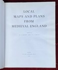
Local Maps and Plans from Medieval England
£325.00
or Best Offer
From £15.33 per month for 24 months with *
Condition:
“Number 369 of just 500 such copies. Publisher's dark blue hardback with gilt lettering along the ”... Read moreAbout condition
Very Good
A book that has been read and does not look new, but is in excellent condition. No obvious damage to the book cover, with the dust jacket (if applicable) included for hard covers. No missing or damaged pages, no creases or tears, no underlining or highlighting of text, and no writing in the margins. Some identifying marks on the inside cover, but this is minimal. Very little wear and tear. See the seller’s listing for full details and description of any imperfections.
- Buy it nowLocal Maps and Plans from Medieval England
Oops! Looks like we're having trouble connecting to our server.
Refresh your browser window to try again.
Postage:
£175.76 International Priority Shipping to United States via eBay's Global Shipping Programme.
Located in: Cheltenham, Gloucestershire, United Kingdom, United Kingdom
Import charges:
Free amount confirmed at checkout
Delivery:
Estimated between Thu, 15 May and Thu, 22 May to 43230
Includes international tracking
Returns:
14 days return. Buyer pays for return postage. If you use an eBay delivery label, it will be deducted from your refund amount.
Payments:
*From £15.33 per month for 24 months.
Shop with confidence
Seller assumes all responsibility for this listing.
eBay item number:354185128856
Item specifics
- Condition
- Very Good
- Seller notes
- ISBN
- 9780198223634
- Publication Year
- 1986
- Type
- Textbook
- Format
- Hardcover
- Language
- English
- Publication Name
- Local Maps and Plans from Mediaeval England
- Item Height
- 380 mm
- Publisher
- Oxford University Press
- Subject
- Geography & Geosciences, History
- Item Weight
- 3368 g
- Item Width
- 280 mm
- Number of Pages
- 392 Pages
About this product
Product Information
This is a major work of scholarship on the nature and significance of local cartography in the Middle Ages. It reproduces - in colour if the original is coloured - all local maps dated before 1501 that were known to survive when the book went to press; more than half have never before been reproduced or described in print. The volume has been produced to the highest standards by the Printer to the University, and is limited to an edition of five hundred copies, numbered by hand. The medieval maps of the whole of England or Scotland are few in number and well known; but maps of smaller areas in Britain from the Middle Ages have mostly been little investigated until now. In all there are thirty such maps or related groups: the earliest dates from the mid-twelfth century, but most come from the fifteenth century and they differ widely in purpose, style, and elaboration. Accompanying each map in this volume is an article by a distinguished scholar knowledgeable in the area, placing it in its local and historical setting. Modern survey maps of the same area are included in the articles for reference. The editor's introduction discusses the maps as a group, in the context of local maps from other parts if Europe and of the general early development of topographical mapping. Among other conclusions it is suggested that even the simplest sketch-map involves concepts that were not familiar to our medieval ancestors; that these maps had no connection with the development of surveying - the union of map-maker and surveyor was to come later; and that they share characteristics with maps produced in widely differing cultures and periods. The maps themselves vary from the roughest sketches to elaborate pictorial compositions; but they all reflect medieval man's response to the landscape around him and his attempts to portray it in what we now recognize as cartographic form.
Product Identifiers
Publisher
Oxford University Press
ISBN-13
9780198223634
eBay Product ID (ePID)
87647137
Product Key Features
Number of Pages
392 Pages
Publication Name
Local Maps and Plans from Mediaeval England
Language
English
Subject
Geography & Geosciences, History
Publication Year
1986
Type
Textbook
Format
Hardcover
Dimensions
Item Height
380 mm
Item Weight
3368 g
Item Width
280 mm
Additional Product Features
Editor
R. A. Skelton, P. D. A. Harvey
Country/Region of Manufacture
United Kingdom
Item description from the seller
Seller business information
VAT number: GB 791253618
I provide invoices with VAT separately displayed.
CRN: 07981438

Popular categories from this shop
Seller Feedback (594)
- r***b (9)- Feedback left by buyer.Past 6 monthsVerified purchaseBooks received promptly, condition as described. Care had been taken to wrap the books with layers of protective bubble wrap and card, which was much appreciated. Many thanks. Highly recommend the seller.
- f***r (889)- Feedback left by buyer.Past 6 monthsVerified purchaseA beautiful book as described, well packed and next day delivery, many thanks
- 2***b (557)- Feedback left by buyer.Past 6 monthsVerified purchaseSubhanAllah Amazing book! A+++ Seller as described and arrived on timeThe Mystical Philosophy of Khawaja Moinud-Din Hasan Chishti (#353491183058)
More to explore:
- Street Maps & City Plans,
- England Wall Maps,
- England Folding Map Maps & Atlases in English,
- England Street Maps/Directories,
- England Paperback Maps & Atlases in English,
- This England Magazines,
- This England Magazines in English,
- Folding Map Maps & Atlases,
- London Folding Map Maps & Atlases,
- Maps & Atlases in Italian Folding Maps
Popular categories from this shop
Seller Feedback (594)
- r***b (9)- Feedback left by buyer.Past 6 monthsVerified purchaseBooks received promptly, condition as described. Care had been taken to wrap the books with layers of protective bubble wrap and card, which was much appreciated. Many thanks. Highly recommend the seller.
- f***r (889)- Feedback left by buyer.Past 6 monthsVerified purchaseA beautiful book as described, well packed and next day delivery, many thanks
- 2***b (557)- Feedback left by buyer.Past 6 monthsVerified purchaseSubhanAllah Amazing book! A+++ Seller as described and arrived on timeThe Mystical Philosophy of Khawaja Moinud-Din Hasan Chishti (#353491183058)