Picture 12 of 12
Image not available


Gallery
Picture 1 of 12
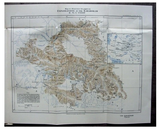
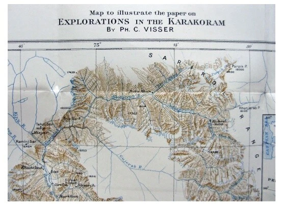
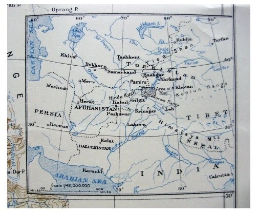
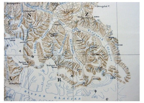
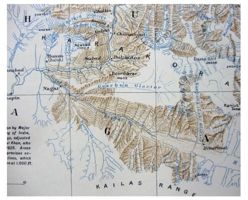
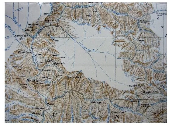
North Karakoram range, Pakistan Border map, Ph C Visser, RGS Dec 1926
£165.93
From £14.76 per month for 12 months with *
Condition:
- Buy it nowNorth Karakoram range, Pakistan Border map, Ph C Visser, RGS Dec 1926
Oops! Looks like we're having trouble connecting to our server.
Refresh your browser window to try again.
Postage:
Located in: Monmouth, United Kingdom
Delivery:
Varies
Returns:
No returns accepted.
Payments:
*From £14.76 per month for 12 months.
Shop with confidence
Seller assumes all responsibility for this listing.
eBay item number:264717682347
Item specifics
- Year
- 1926
- Date Range
- 1920-1929
- Country/Region
- Pakistan
Item description from the seller
About this seller
rachel2919
100% positive Feedback•239 items sold
Registered as a private sellerThereby, consumer rights stemming from EU consumer protection law do not apply. eBay buyer protection still applies to most purchases.
Seller Feedback (115)
- b***c (8463)- Feedback left by buyer.Past yearVerified purchaseItems Received , Thank YouLego Atlantis Typhoon Turbo Sub (8060) 99% Complete With Box and Instructions (#264904021402)
- e***a (2954)- Feedback left by buyer.Past yearVerified purchaseOrder cancelled by seller. Refund issued immediately. Thank you.100% Linen shirt beige/ecru Size 14 but relaxed fit (#265205458324)
- n***n (420)- Feedback left by buyer.More than a year agoVerified purchaseGood sellerRadley Small Hot Pink Cerise Shoulder Bag (#266704594384)
More to explore:
- North Dakota Antique North American Maps & Atlases 1900-1909 Date Range,
- North Carolina Antique North American Maps & Atlases 1800-1899 Date Range,
- North Dakota Antique North American Maps & Atlases 1920-1929 Date Range,
- 1900-1909 Date Range Political Map Antique North America Atlas Maps,
- Antique North American Maps & Atlases 1500-1599 Date Range,
- 1700-1799 Date Range Antique North America City Maps,
- 2000-Now Date Range Antique North America Folding Maps,
- 1990-1999 Date Range Antique North America Topographical Maps,
- 1920-1929 Date Range Antique North America Wall Maps,
- 1800-1899 Date Range Antique North America Sheet Maps