Picture 1 of 1

Gallery
Picture 1 of 1
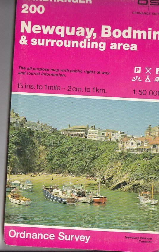
Ordnance Survey 1:50,000 Landranger Map Sheet 200 Newquay, Bodmin & surrounding
£4.72
Condition:
“Minor edgewear to cover. Map clean and unmarked.”
Very Good
A book that has been read and does not look new, but is in excellent condition. No obvious damage to the book cover, with the dust jacket (if applicable) included for hard covers. No missing or damaged pages, no creases or tears, no underlining or highlighting of text, and no writing in the margins. Some identifying marks on the inside cover, but this is minimal. Very little wear and tear. See the seller’s listing for full details and description of any imperfections.
- Buy it nowOrdnance Survey 1:50,000 Landranger Map Sheet 200 Newquay, Bodmin & surrounding
Oops! Looks like we're having trouble connecting to our server.
Refresh your browser window to try again.
Postage:
Located in: Greenock, Strathclyde, United Kingdom
Delivery:
Varies
Returns:
No returns accepted.
Payments:
Get more time to pay. See payment informationfor PayPal Credit - opens in a new window or tab
Shop with confidence
Seller assumes all responsibility for this listing.
eBay item number:235034729666
Item specifics
- Condition
- Very Good
- Seller notes
- “Minor edgewear to cover. Map clean and unmarked.”
- ISBN
- 9780319222003
- Publication Year
- 1992
- Type
- Travel Maps
- Format
- Sheet Map
- Language
- English
- Publication Name
- Landranger Maps: Sheet 200: Newquay, Bodmin and Surrounding Area
- Item Height
- 1000 mm
- Map Scale
- 1:50,000
- Publisher
- Ordnance Survey
- Subject
- Transportation, Sports
- Item Width
- 990 mm
About this product
Product Information
This map is part of the Landranger (Pink) series and is designed for people who really want to get to know an area. It includes the following information: tourist information, camping and caravan sites, picnic areas and viewpoints, selected places of interest and rights of way information for England and Wales. Each map in the series covers an area of 40 km by 40 km (25 miles by 25 miles) and like other Ordnance Survey maps, National Grid squares are provided so that any feature can be given a unique reference number. Perfect for planning ahead and local excursions, these maps are full of useful information that will help you really get to know an area.
Product Identifiers
Publisher
Ordnance Survey
ISBN-13
9780319222003
eBay Product ID (ePID)
86863894
Product Key Features
Publication Year
1992
Subject
Transportation, Sports
Language
English
Publication Name
Landranger Maps: Sheet 200: Newquay, Bodmin and Surrounding Area
Type
Travel Maps
Map Scale
1:50,000
Format
Sheet Map
Dimensions
Item Height
1000 mm
Item Width
990 mm
Volume
0200
Additional Product Features
Country/Region of Manufacture
United Kingdom
Series Title
Os Landranger Map
Item description from the seller
About this seller
stevouk
100% positive Feedback•5.8K items sold
Registered as a private sellerThereby, consumer rights stemming from EU consumer protection law do not apply. eBay buyer protection still applies to most purchases.
Seller Feedback (3,027)
- o***w (76)- Feedback left by buyer.Past 6 monthsVerified purchaseAs always product received as described. At the moment this Seller the go to contact for Ordnance First Series maps. Good price and prompt service.Ordnance Survey (OS) 1:25,000 First Series Map Sheet SD 63 Longridge Lancashire (#235520661563)
- *****- Feedback left by buyer.Past 6 monthsVerified purchaseMany thanks for an easy, top-quality transaction. The map is in excellent condition - accurately described, securely packaged and promptly dispatched. Very pleased with this seller's 5* level of service and can highly recommend.
- *****- Feedback left by buyer.Past 6 monthsVerified purchaseThe item arrived. as described by the seller, in suitable packaging and. within the advertised time frame. A good service, thank you.
Product ratings and reviews
Most relevant reviews
- 21 Apr, 2021
Lost in Cornwall.NO LONGER
Verified purchase: YesCondition: Pre-owned
- 05 Aug, 2021
.
Verified purchase: YesCondition: Pre-ownedSold by: phoenixbooksandcrafts
More to explore:
- Ordnance Survey Hiking Maps,
- Ordnance Survey Maps & Atlases,
- Ordnance Survey Folding Map Maps & Atlases,
- Ordnance Survey Irish Maps & Atlases,
- Ordnance Survey London Maps & Atlases,
- Ordnance Survey European Maps & Atlases,
- Ordnance Survey Laminated Maps & Atlases,
- Ordnance Survey United Kingdom Maps & Atlases,
- Ordnance Survey 1st Edition English Maps & Atlases,
- Ordnance Survey 1900-1949 Publication Year Maps & Atlases