Picture 1 of 1

Gallery
Picture 1 of 1
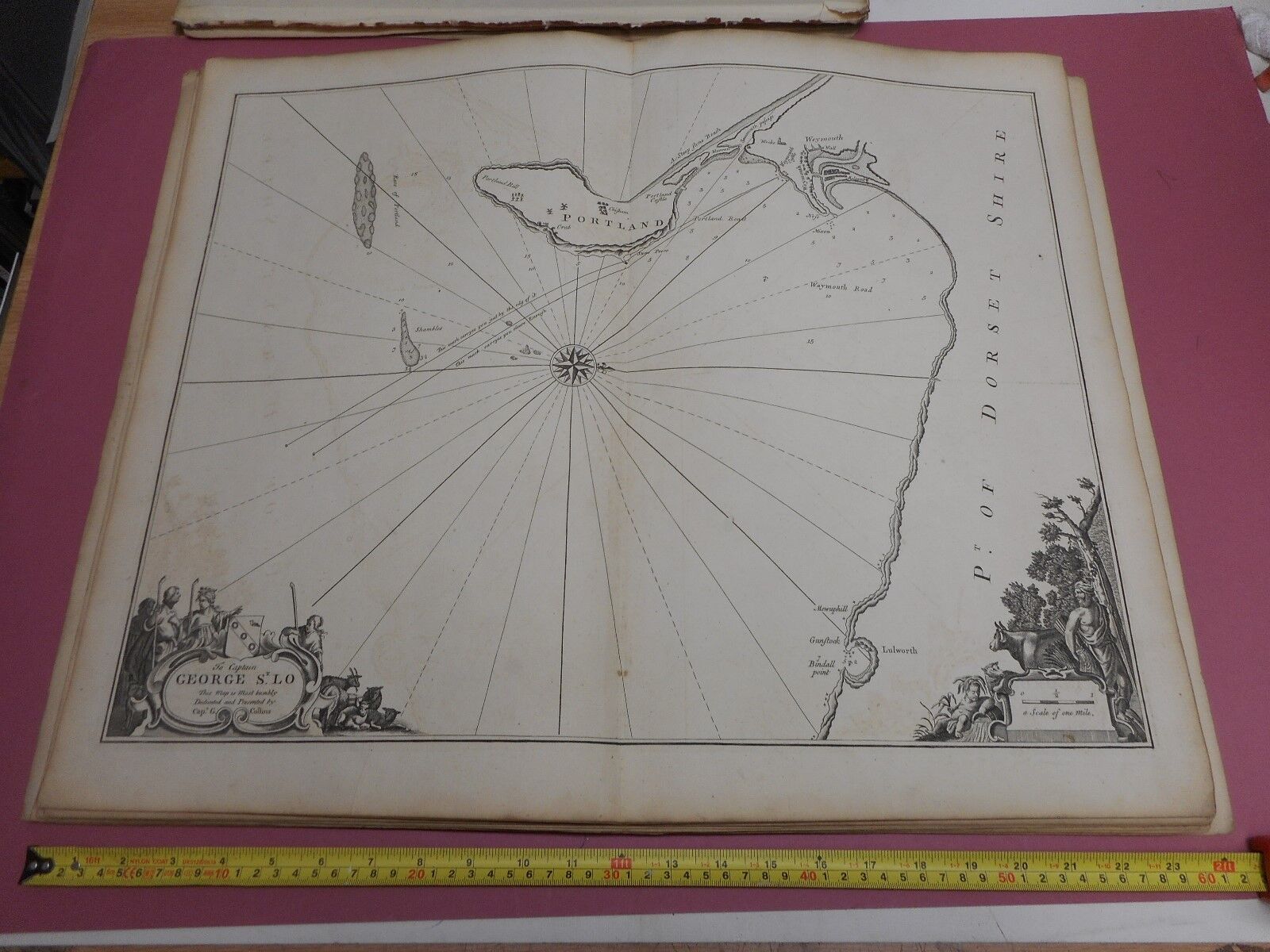
100% ORIGINAL SEA CHART PORTLAND BILL DORSET MAP ENGR. BY COLLINS C1760 VGC
£150.00
From £13.34 per month for 12 months with *
Condition:
- Buy it now100% ORIGINAL SEA CHART PORTLAND BILL DORSET MAP ENGR. BY COLLINS C1760 VGC
Oops! Looks like we're having trouble connecting to our server.
Refresh your browser window to try again.
Postage:
£15.00 Royal Mail International Tracked.
Located in: MARKET HARBOROUGH, Leicestershire, United Kingdom
Delivery:
Estimated between Thu, 17 Apr and Fri, 25 Apr to 43230
Returns:
14 days return. Buyer pays for return postage. If you use an eBay delivery label, it will be deducted from your refund amount.
Payments:
*From £13.34 per month for 12 months.
Shop with confidence
Seller assumes all responsibility for this listing.
eBay item number:202663498283
Item specifics
- Year
- 1760
Item description from the seller
Seller business information
About this seller
wildlone40mapshop
100% positive Feedback•16K items sold
Registered as a business seller
Popular categories from this shop
Seller Feedback (10,355)
- p***p (6)- Feedback left by buyer.Past 6 monthsVerified purchasewell packaged for shipping. timely delivery. item was exactly as described. good value. will purchase from this seller again. thank you.100% ORIGINAL LARGE LONDON AREA MAP BY BARTHOLOMEW C1890 VGC (#196633395192)
- i***e (447)- Feedback left by buyer.Past monthVerified purchaseGood postage cost. Packed well. Great condition as described, at a very good price for an item that is not easily availabe.
- t***e (9)- Feedback left by buyer.Past monthVerified purchasePositive experience with item as described, timely delivery, well packed - very professional and easy purchase.
More to explore:
- Dorset Vintage Original Antique Europe Sheet Maps,
- Dorset Antique Original Antique Europe Sheet Maps,
- Dorset Antique Original Antique Europe Atlas Maps,
- Dorset Vintage Original Antique Europe Maps & Atlases,
- Dorset Antique Original Antique Europe Wall Maps,
- Dorset Antique Europe Folding Maps,
- Dorset County Map Antique Europe Atlas Maps,
- Dorset Antique Europe County Maps,
- Dorset Antique Europe Ordnance Survey Maps,
- Dorset 1700-1799 Date Range Antique Europe County Maps